- CCT Public Page
- [CCT Members Area]
The contents of this page are originally from http://www.geocities.com/neckdeeppowpow/
Tasmania has the reputation of being flat, small and having no snow. This reputation may be well deserved when it comes to Ben Lomond, but when it comes to getting out into the backcountry it is far from the truth.
Cradle Mountain and other mountains the the Cradle Mountain National park have some of the steepest and most exposed skiing in Australia. This is largely due to the geology of the area where the mountians are made up of vertical dolerite columns, these then fall of creating steep chutes and steep scree faces on the higher peaks. Although the snow can be inconsistent, the southern facing slopes in the in the park has very consistent snow cover and therefore skiing can be had right up until late in the year.
Ben Lomond
Ben Lomond is the "premier" Tasmanian ski resort. It's pretty crap really, but the locals have plenty of fun. It has a poled route from the village out to Little Hell. The slope down from Little Hell is steeper and longer than anything on piste, but needs a good cover to be skiable. There are also rumours about some very steep chutes on the eastern edge of the escarpment.
- Snow report and ski cam: http://ski.com.au/reports/benlomond/
- National Parks: http://www.parks.tas.gov.au/natparks/benl/index.html
Map from the NPWS site showing the poled route out to Little Hell
Mt Field
Mt Field has some good backcountry skiing, and it is relatively close to Hobart (an hour and a half). Don't worry about the rope tows, the backcountry is much better.
With a decent cover the touring around the Mt Field area is great. You can do a circuit around the Mt Mawson area, or follow the Rodway Range right out to Mt Field West.
There are also a lot of steep backcountry runs. Be careful on the Golden Stairs when it is loaded - there was a death due to an avalanche in the 1970s.
Snow report and ski cam: http://ski.com.au/reports/mawson/
The golden stairs from Lake Dobson, 2004.
Looking across the Golden Stairs, 2004
The Rodway Range and Rodway Tow, 2004.
Chutes leading down to Lake Belcher from K Col
The very tight chute leading from the top of the Tarn Shelf, as seen looking over from the approach to Rodway tow
More Mt Field Photos:
- http://www.pbase.com/tasmart/mt_field_skiing
- Mt Field Snow - couple of great photos of Florentine Peak under lots of snow
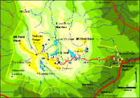
Map of Mt Field park from NPWS site
Map of Lake Dobson area from NPWS site
Cradle Mountain
Cradle mountain offers some of the easiest accessable steep skiing in Tassie, the walk up the mountain is relatively easy and it is only a 4 hour walk to the summit, with good snow caving areas around the mountain as well.
There are several good areas to ski when the snow is good.
The easiest to access is a chute that starts at the notch immediately south of Marions Lookout. It requires a recent heavy fall but provides a fun, steep line that continues most of the way down to the Dove Lake Circuit track. Several other smaller chutes can be found on the western side of Crater Lake and on the ridge that leads down to Riggs Pass.
The chutes that are visable from the lake dove carpark offer some exciting skiing without the exposure, there are plenty of chutes to choose from in the area and there is chutes for varied abilities, ranging from 3m wide to 20m wide.
The main area of the mountain is to be found over the back, the area looks small from the summit but once down over the first ridge it becomes apparent that the area is very large. The backbowl is made up of three open faces, and two chutes that head down towards lake Rodway at the back of the mountain. (see Pic 1)
The two chutes are about 700m long with an angle of between 35 and 45 degrees, The walk out of each takes around 45 minutes. A snow cave is easily built at the top of the runs just near the main summit track.
Mt Ironstone
TODO
Mt Ossa
Mt Ossa offers something a bit different to cradle mountain, its open bowl and steep face offers something not usually found in tasmania. The mountain is tasmanias highest at 1617m and hold large amounts of snow for most of the winter.
The easiest accessable line on the mountain is found on the main ascent track, this line starts with some technical skiing with some drops up at the start of the run, the the face opens out and some fast skiing on the open bowl can be had, with a pitch of about 30 degrees it is some challenging skiing without having the exposure of cradle mountain. Towards the bottom there is a large cliff so be carfull to stop before hiting this.
Over on the left there is the centre chute, this chute holds a large amount of snow and i have saw lots of avalanche debree towards the bottom of it. There are several technical sections when the snow is bit thiner, with several drops. The bottom section opens out to some fast flowing skiing.
I have also scoped several lines between the two main butresses, and they look possible from the air, however there are several small drops and these would only really be possible in good snow, the section would also be prone to avalanche as there are several large cornices at the top of the section.
Really the whole of Mount Ossa is skiable, including the north and east facing slopes in good snow, however because of the open terrain it seems to be prone to slide especially after some sunny days.
Access to Mount Ossa can be via the 14km arm river track or via the overland track itself. Pelion hut is about 4 hours from the top, and there is good snow caving in a sheltered gully on the top also.
Mt Ossa. Photo by Iain Wilson.
Mt Ossa. Photo by John Chapman
Mt Rufus
Mt Rufus has some good terrain and gets a reasonable amount of snow. It was considered as a place for a ski resort in the 50s, but measurement of the snow showed it wasn't reliable enough.
The two main tracks start at Lake St Clair, it takes about 3 hours to the snow line. The direct track (southern-most) climbs a a wide east facing slope which generally seems to hold the best snow on the mountain. It offers some steep turns at the top and a long run down through the trees at the base. Watch out for cornices at the top as avalanches have occurred here.
A third, less frequented track starts from the Rufus canal road and approaches the summit from the south, passing two old ski huts. The southern slopes are extensive and provide lots of gentle slopes with the odd steep drop, though the snow doesn't seem to be as reliable as the eastern face.
More info here: http://www.parks.tas.gov.au/factsheets/walking_notes/MtRufusDayWalks.pdf
Mt Anne
There is good skiing over the Eliza Plateau, however it is quite exposed. Its about 2-3 hours solid walk to gain the altitude. The base of summit block can be reached in another couple of hours of easy skinning. While there are no feasible lines down from the summit (for anyone who values their life) there are several truly spectacular lines that drop down the huge south-east facing bowl between Shelf Camp and the summit block. The most obvious of these starts at the junction between the summit track and the circuit track and heads steeply down towards a vertical sided chute just visible from the top. One inside the chute, which is dead straight and more like a slot canyon, you can continue on for several hundred meters. This is only achievable in excellent snow conditions.
It also looks like there's a nice chute directly below the summit block (the climber's descent route), which goes for a couple of hundred meters before it ends in cliffs.
There are some shots of Mt Anne under snow here: Mt Anne Gallery.
Walls of Jerusalem
The Walls of Jerusalem National Park has a wealth of wonderful touring terrain if you can catch the right conditions. Access is relatively quick: you will need a four wheel drive vehicle or carry chains to get to the road head.
It's about an hour walk from the car park up to the Trapper's Hut, where you can strap the boards on and start skiing.
Chaining up on the drive in.
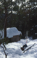
The Trapper's Hut
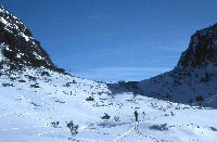
Looking towards West Wall
Approaching Herrod's Gate
Crossing Lake Salome
West Wall
Frenchman's Cap
Frenchmans Cap requires a lot of effort (even with the improved track) but offers some big, technical lines with a serious mountaineering feel. Lake Tahune hut can be reached in a day, or more comfortably two, which would be advisable after recent snow. There is a lot of low branch limbo-ing to be had on the climb up to Barrons Pass and very little opportunity for skinning given the rugged nature of the track. Skins are probably best left at home in fact. The face/bowl above Lake Tahune has the most obvious and less extreme skiing, but it is still incredibly steep at the top, and in icy conditions it could be quite dangerous. There are gentler, expansive snow fields on the eastern side of the summit, but connecting these with the Lake Tahune face would require some very tight, technical and insanely exposed skiing. It would however, provide an uninterrupted 450m vertical descent through stunningly rugged terrain. There may also be possible skiing around Lion's Head, and even out towards Clytemenstra.
Snowy Range
TODO


